|
|
Post by salmoneye on May 7, 2011 8:20:04 GMT -5
what a mess a wait till june hope it better than We have been in this weather pattern since September...La Niña is kicking our @$$: A new La Niña episode developed quite quickly in the eastern and central tropical Pacific in mid-2010,[4] and lasted at least until early 2011.[1] This La Niña, combined with record high ocean temperatures in the north-eastern Indian Ocean, has been a large factor in the 2010–2011 Queensland floods,[5] and the quartet of recent heavy snowstorms in North America starting with the December 2010 North American blizzard. The same La Nina event is also a likely cause of a series of tornadoes of above-average severity that struck the midwestern United States in the spring of 2011.[6]en.wikipedia.org/wiki/La_Niña |
|
|
|
Post by Sundown on May 7, 2011 9:55:48 GMT -5
Wow !! Thank's for the great but sad pixs.
Thank God for the forum, it has save me some
wasted trips. All you guy's that have taken the time
to take pictures and and post conditions deserve a
big vote of thanks
Steve................aka Sundown
|
|
woz
Full Member

Posts: 33
|
Post by woz on May 7, 2011 10:11:36 GMT -5
The slang is launchable. We launched a 19 foot bass boat there last Sat - Tues. It will be difficult for 1 person though, you`ll need boots!
|
|
|
|
Post by bassgeek (Brock) on May 8, 2011 7:09:46 GMT -5
Plenty of people were launching off the south side at Larabee's yesterday. My Boy Scout troop and I even cleaned up the ash pile with all the nails in it from the pallets someone burned in the turn around. We took a pick-up truck load of trash out of there yesterday. Really depressing, considering there is probably a bunch more trash hiding under all the water  |
|
|
|
Post by schodackbassman on May 8, 2011 17:17:03 GMT -5
State of Vermont is lucky to have you and the scouts to help keep the launch usable. Those nails could really ruin someones day.
|
|
|
|
Post by bassbuggy on May 8, 2011 18:36:38 GMT -5
THANKYOU ! The amount of traffic in and out this weekend has been astounding.  |
|
|
|
Post by southern on May 8, 2011 18:54:34 GMT -5
unbelieveable
|
|
|
|
Post by xpressx21 on May 9, 2011 10:02:13 GMT -5
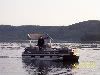
Thanks for the view great pic's. Does anyone know what the TI ramp on the NY side looks like. Look at the ferry pic from the VT side. Now imagine several feet of water coming up the TI side. It's a steep ramp so it might be launchable. But I'm guessing the docks are out. |
|